
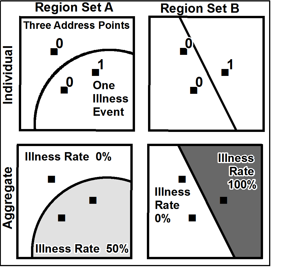
The Modifiable Areal Unit Problem (MAUP) is a well-known issue in Spatial Analysis that arises when the results of an analysis change depending on how the data is aggregated into different spatial units.
The MAUP can be addressed by using a variety of techniques, such as spatial smoothing, interpolation, modeling, or testing the sensitivity of the results to different spatial units used to represent data. However, in some cases, these techniques may not be sufficient to completely eliminate the effects of spatial aggregation on the results of the analysis.
One example of a situation where the MAUP may be difficult to address is when the spatial units used to represent data do not align with the underlying spatial processes that generate the data. For example, if the spatial units used to represent data are administrative boundaries that do not reflect the natural patterns of the phenomena being analyzed, then the MAUP may be difficult to address, as the spatial variability of the data may not be captured by the available spatial units.
Source of the image: Wikipedia.